
i n s i g h t s
Understanding GPR: The Basics
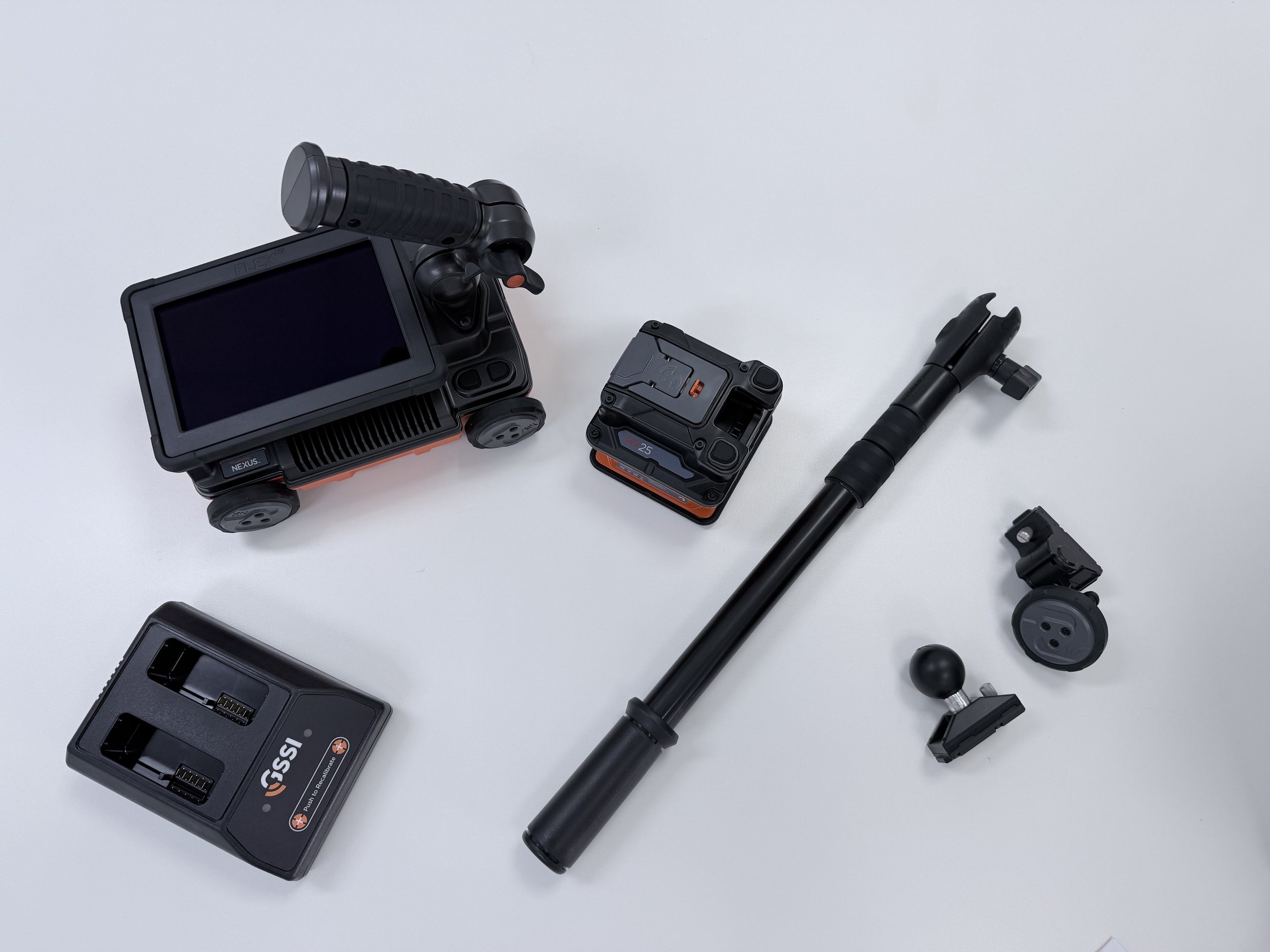
Ground Penetrating Radar (GPR) is a non-destructive method that uses radar pulses to detect objects and changes in material beneath the surface. It works by sending high-frequency radio waves into the ground or concrete. When these waves encounter a buried object or material boundary, they reflect back to the surface and are captured by a receiver. This data is then processed to create a visual map of what lies beneath — including rebar, post-tension cables, conduits, voids, and changes in material density.
Why GPR Matters in Construction?
Before any cutting, drilling, or excavation takes place, it’s essential to know what’s below the surface. Striking a live conduit, structural cable, or water pipe can lead to serious safety hazards, costly damage and delays, legal and compliance issues, and even project shutdowns. GPR scanning helps prevent these risks by providing accurate, real-time data — allowing teams to work confidently and safely.
Applications of GPR in the Field
At SCSS, we use GPR across a wide range of projects, including concrete slab scanning before coring or cutting, structural assessments for rebar and cable layout, void detection in ageing infrastructure, pre-design surveys for renovations, and utility locating in conjunction with EM detection. Our technicians are trained to interpret GPR data with precision, ensuring you get clear, actionable insights — not just raw scans.
Why choose SCSS for GPR Services?
We’re not just GPR operators — we’re certified, experienced professionals who understand the construction environment. Our team is Telstra Certified, BYDA/Certloc Accredited, backed by years of experience in Tier 1 construction projects, and supported by a full-service team including estimators, project managers, and field technicians. We integrate GPR scanning with other services like utility locating, 3D mapping and CCTV camera inspections — making SCSS your one-stop shop for subsurface solutions.
Planning a project? Don’t risk what’s beneath the surface. Contact SCSS today for expert GPR scanning and subsurface investigations.
1800 00 SCAN | info@scss.net.au
Avoiding Utility Strikes: The Importance of Certified Locators
Understanding the Risk of Utility Strikes
Striking underground utilities such as electrical, gas, telecommunications, water or other buried services can result in serious injury, significant project delays, service interruptions and substantial repair costs.
Many utility strikes can be avoided through appropriate planning, investigation and the use of suitably qualified utility locating professionals before excavation, drilling or other intrusive works commence.
Why Certification Matters
Engaging appropriately trained and certified locating technicians provides greater confidence that underground services are being investigated in accordance with recognised industry practices and relevant asset-owner requirements.
At SCSS, our utility locating technicians hold relevant certifications and accreditations, including Before You Dig Australia (BYDA), CERTLOC, Telstra and Optus.
This combination of training, certification and practical field experience allows our team to undertake utility locating works with a strong focus on accuracy, safety and risk reduction.
Our Utility Locating Process
SCSS utilises a combination of electromagnetic (EM) pipe and cable locating equipment and Ground Penetrating Radar (GPR) to investigate and trace underground services.
Using multiple technologies allows our technicians to assess both conductive and non-conductive services where site conditions permit, providing a more comprehensive investigation than relying on a single locating method alone.
The results can then be clearly marked onsite and, where required, incorporated into project-specific reports, drawings or digital mapping deliverables.
Reducing Risk Before Works Begin
Accurate utility locating is an important part of planning excavation, drilling, trenching and other intrusive works. Identifying potential underground services before work commences can significantly reduce the likelihood of service strikes, improve site safety and minimise unexpected disruption.
Protect your workforce, your project and existing infrastructure by engaging SCSS for professional utility locating services.
1800 00 SCAN | info@scss.net.au
3D UTILITY MAPPING: bring your project to life via 3d viewing:
A Clearer View of Underground Infrastructure
Traditional utility locating provides critical information about the position and depth of underground services. 3D utility mapping takes this a step further, transforming field-collected data into a spatial representation that allows project teams to better understand how underground infrastructure relates to the surrounding site.
By visualising identified services in three dimensions, engineers, designers, contractors and project managers can gain a clearer understanding of complex underground environments before construction or excavation works commence.
From Field Data to 3D Visualisation
SCSS combines advanced utility locating equipment with survey-grade positioning technology to capture the location of identified underground services.
Where project conditions and data quality allow, this information can be incorporated into a 3D digital model, providing a more intuitive way to review service locations, alignments, depths and relationships with other site features.
This can be particularly valuable on projects involving congested service corridors, major infrastructure, redevelopment works, data centres, commercial developments and sites where accurate spatial coordination is critical.
Supporting Better Project Coordination
3D utility mapping can assist project teams with:
Visualising the relationship between multiple underground services
Identifying potential clashes before construction begins
Supporting design and construction planning
Improving communication between consultants, contractors and stakeholders
Assisting with excavation and penetration planning
Providing a clearer digital record of investigated utilities
Integrating utility information into CAD and 3D project environments
Project-Specific Digital Deliverables
Every project has different requirements. SCSS can tailor its 3D utility mapping deliverables to suit the intended use of the data, including CAD-based drawings, 3D models and other compatible digital formats, subject to the scope of investigation and available site information.
Our approach is focused on providing practical, accurate and usable information that can be incorporated into the wider project workflow.
Bring Underground Information Into View
By moving beyond traditional two-dimensional plans, 3D utility mapping provides project teams with a more comprehensive understanding of existing underground infrastructure.
SCSS combines advanced locating technology, spatial data collection and digital mapping to help bring underground conditions to life and support safer, better-informed project decisions.
Want to learn more about 3D mapping? Contact SCSS to speak with one of our 3D specialists today.
1800 00 SCAN | info@scss.net.au
REPORTING OPTIONS: Which Is Right for Your Project?
At SCSS, we understand that every project has different requirements. That is why we offer a range of reporting options designed to suit the specific scope, complexity and deliverables required for each project.
Whether you require a simple marked-up plan, detailed scanning report, utility investigation report or comprehensive digital mapping package, our reporting can be tailored to provide the level of information your project team needs.
Service-Specific Reporting
Each of our services can be supported by reporting specifically designed around the type of investigation being undertaken. This ensures the information provided is relevant, practical and easy for contractors, consultants, engineers and project managers to interpret.
Reporting options are available for services including concrete scanning, utility locating, slab thickness investigations, structural investigations, reinforcement mapping and subsurface mapping.
Tailored to Your Project Requirements
Not every project requires the same level of reporting. Some clients may only require clear onsite markings and a basic summary, while larger or more complex projects may require detailed findings, photographs, depth information, annotated drawings, investigation methodology and identified limitations.
SCSS can tailor the reporting package to suit your project specifications, consultant requirements, construction methodology or client documentation standards.
From Onsite Markings to Detailed Digital Deliverables
Depending on the service and project requirements, reporting can include:
Annotated site plans and drawings
Photographic records of investigation areas
Identified services, reinforcement and structural features
Approximate depth and location information
GPR investigation findings
Slab thickness and structural information
Utility locating results
Investigation methodology and equipment used
Areas of uncertainty or investigation limitations
CAD, DWG or other digital mapping outputs where required
Detailed project-specific technical reports
The Right Level of Information for the Job
Our aim is to provide clients with useful information — not unnecessary documentation. By selecting the appropriate reporting level for each project, SCSS can provide clear and practical deliverables that assist with planning, design, drilling, excavation, construction and ongoing project coordination.
If you are unsure which reporting option is most suitable, our team can review your project requirements and recommend the most appropriate level of reporting for the works.
Need more information regarding our reporting options? Contact SCSS for professional advice today.
1800 00 SCAN | info@scss.net.au